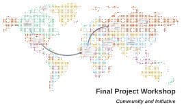
Map Projection Project
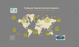
Transcript: The Mercator Projection & Van Sant's Geosphere The Mercator Van Sant's Geosphere This map is the very first satellite produced map, constructed during the Geosphere Project. Pictures of Earth were taken from space to construct this accurate view of our world and how the world most accurately appears. Van Sant made this map to make the world easier to understand in hopes of understanding Earth's process. It is now the top selling world map and is used by many countries, organizations and atlases. Van Sant's Geosphere marks no lines of latitude or longitude. The map has no special purpose, it is just a general, but accurate image. The map cannot be recreated, since it is taken by advanced satellite technology. There are also no countries, or continents labeled, nor is there an equator. From what we know of Gerardus Mercator and the Mercator map, we believe that Mercator thought that during this time, exploring the America's from Europe was a very important mission. That is why he enlarged the America's and Europe so sailors could sail to and from easier. From the knowledge we have of Tom Van Sant, we believe that Van Sant wanted to educate the world on the actual shape of the world, it's continents, and how the Earth, as a whole, works. (geosphere.com) What are this projection’s weaknesses? In 1569, a geographer and cartographer, Gerardus Mercator, created this map. He was born in Flanders, Belgium on March 5, 1512, with an original name of Gerard de Kremer. He passed away on December 2, 1594 in Duisberg Duchy of Cleve, Germany. What are this projection’s strengths? Gerardus Mercator: When the Mercator map was developed in 1569 it was used to navigate the the world's seas. The maps used straight lines for latitude and longitude which in turn serve as constant compass bearing lines which help a navigator move in a "straight" direction. So when a navigator sets sail he understands what direction he should point his compass to get to his destination. The name of the map is "nova et aucta orbis terrae description ad usum navigantium emendate et accomodata" which literally translates from latin into: new and improved description of the world amended and intended for the use of navigators. Overall, we preferred Van Sant's Geosphere more. This is because we liked the way how the countries/continents were all size and shape proportionate. We found the map easier to use compared to the Mercator Projection, which was not size proportionate in most areas. What might this reflect about the creator’s worldview? The Mercator is geographically inaccurate in many ways. The scale is distorted in several places. Many of the countries and continents shape and size have been altered, especially the farther north and south latitudes. The farther away from the equator, the larger the area appears. The map was altered in order to benefit sailors crossing the Atlantic, but this causes the map to not be useful for many things other than sailing and aviation. What was the original purpose of this map? What are this projection’s strengths? Tom Van Sant: The Mercator maps has several key strengths. There are many straight lines on the map, which are longitudinal and latitudinal. These lines are easy to navigate, and easy to for travelers to determine their destination. It shows lines of a constant course, and there is an accurate distance and shape between all of the countries. This map is very direct, so sailors and pilots would never have to worry about the direction shown to lead them off the map. What might this reflect about the creator’s worldview? This map is very accurate representation, via satellite. The map seemed different from all of the others, which gave the world a different perspective. The size is proportionate, and the shape is proportionate in the map. You are able to see dimensions in the ocean/land so elevations are visible, and deserts and forests visible. What are this projection’s weaknesses? What was the original purpose of this map? By Will B., K.J. B., McKenzie D., and Chiru G. Tom Van Sant, an American sculptor, painter and conceptual artist, created the Van Sant's Geosphere, in 1990. He was born in Los Angeles, California in 1931 and is still living. Van Sant’s Geosphere was part of the Geosphere Project, which he founded in 1989, for the development of advanced global and environmental representations.