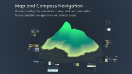
Map and Compass Navigation
Transcript: Map and Compass Navigation Understanding the essentials of map and compass skills for responsible navigation in wilderness areas Best Practices for Responsible Navigation Mastering navigation skills is vital for enhancing outdoor experiences while minimizing environmental impact. By incorporating the Leave No Trace principles and proper navigation techniques, outdoor enthusiasts can ensure their safety and the preservation of natural resources for future generations. Navigating with Triangulation The Importance of Navigation in Outdoor Recreation Engaging in outdoor activities deepens our connection with nature, fostering a desire to preserve it. However, responsible recreation requires understanding navigation skills, ensuring safety, and respecting the environment and fellow outdoor enthusiasts to maintain these natural spaces for future generations. Triangulation is a critical navigational technique that allows you to pinpoint your location even in unfamiliar terrain. By taking bearings to at least two known landmarks, you can draw intersecting lines on a map, revealing your precise position. Understanding the Leave No Trace Ethic The Leave No Trace Ethic consists of seven core principles that serve as guidelines for outdoor enthusiasts. These principles aim to minimize the environmental impact of outdoor activities and promote sustainable interaction with natural resources, ensuring that they remain intact for future generations to enjoy. Handrails for Navigation Handrails are natural or man-made features in the landscape that provide a visual guide to help navigate towards your destination. Common examples include rivers, trails, ridgelines, or roads. By following these features, you can maintain a clear orientation and direction, making it easier to reach your goal without getting lost. Using Handrails and Backstops Plan Ahead and Prepare Pack Out What You Pack In Considerate of Other Visitors Minimize Fire Impact Carrying out what you bring in is crucial to keeping natural areas clean. This principle stresses the importance of not leaving behind trash or litter, thus ensuring that trails and campsites remain pristine for future visitors and wildlife. Minimizing the impact of fires is essential for protecting the environment. This includes using established fire rings, keeping fires small, or avoiding them altogether to prevent wildfires and preserve the natural ecosystem. Planning ahead is essential for ensuring safety and enjoyment during outdoor activities. It involves understanding the environment, knowing the route, and preparing for unexpected situations. Proper preparation minimizes risks for yourself and others in the wilderness. Being considerate of other visitors enhances everyone's outdoor experience. This includes keeping noise levels down, yielding the trail to others, and leaving the area cleaner than found, fostering a friendly and respectful environment in the wilderness. Backstops for Safety Stay on Durable Surfaces Leave What You Find Respect Wildlife Backstops act as a visible boundary that you should avoid crossing while navigating. These features can include cliffs, lakes, or any prominent landmark that signifies the edge of the area you intend to explore. By keeping a backstop in sight, you ensure that you do not accidentally overshoot your destination and can maintain a clear course. Leaving what you find, such as plants, rocks, and historical artifacts, preserves the natural and cultural heritage of an area. This principle encourages visitors to take only memories and photographs, ensuring that the environment remains untouched and beautiful for others. Respecting wildlife is crucial for their protection and the ecosystem's balance. This principle advises against disturbing or feeding wild animals, ensuring they remain wild and healthy while allowing humans to observe them from a distance. Staying on durable surfaces helps to preserve the natural environment by minimizing soil erosion and damage to vegetation. This principle encourages using existing trails and designated campsites to maintain the integrity of the wilderness. Leave No Trace Principles Aiming Off Technique in Navigation Aiming off involves deliberately adjusting your course bearing to navigate to one side of your intended destination. This strategy is particularly useful in conditions where visibility is poor, such as fog or dense forests, allowing you to confirm your path and avoid overshooting your target by knowing which direction to adjust once you can see your destination. Course The Course is the planned route you intend to follow. It can be a straight line or consist of multiple segments (called Legs) that may change direction at different angles. Understanding your course is essential for effective navigation. Leave No Trace and Navigation: A Call to Preparedness Key Navigation Terms – North is at 0 degrees – East is at 90 degrees – South is at 180 degrees – West is at 270 degrees Bearing/Heading